Find Indiana Travel Advisory Info and Weather Warnings with These Resources
Neither rain, nor sleet, nor snow…After all the packing and prep, how do you know where to go for Indiana travel advisory and road condition info? I’ve got multiple ways for you to easily view the current Indiana weather conditions, travel advisories, and even the best smartphone apps to help you plan ahead.
#Indiana weather and road advisory resources--maps, apps, and MORE! #littleindiana Click To TweetYou don’t need to let cold temperatures or spring thawing slow down your Indiana travel planning. Not even a little bit. All you need to do is use this massive resource to find the help you need. When it comes to figuring out what roads to travel, and where to stay away, we’ve got you covered.
As we Hoosiers like to say, “If you don’t like the weather now, just wait five minutes, and it will change.” Don’t take any chances. Use any of the resources listed here on this page to stay on top of our…fickle weather warnings and road closure information.
Indiana Travel Advisory and Road Condition Resources
Indiana Traveler Information
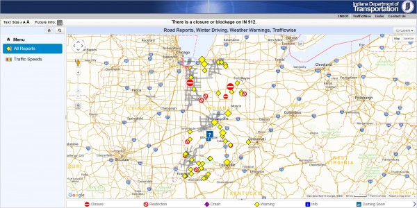
Indiana Department of Transportation Cars Program — I’m as surprised as you, however, this government website actually does a fine job of displaying the latest bumps in the road. You can find out road reports, winter driving, and weather warnings. Icons reveals whether there has been a collision, a restriction (such as the lane of a highway closed or gross weight limits), a closure, and road construction (it will even reveal if there is night-time road construction). It also states other info like if there is construction work, flaggers, and alternating open roads. Clicking on “Future Reports” clues you in on any roads that will be closed or undergoing construction for a length of time. Now that is a helpful Indiana travel trip planning tool!
You can view the speed of cars on particular highways thanks to Google highway speed. Let’s say you were driving along I-65 by the Indiana wind turbines. If you saw the road overlaid with a thick green line–you’re in luck! It means traffic is flowing quickly. If you notice the colors changing from green (fast) to yellow to bright red to dark red (slow), you may be sitting for awhile.
Indiana Real Time Traffic
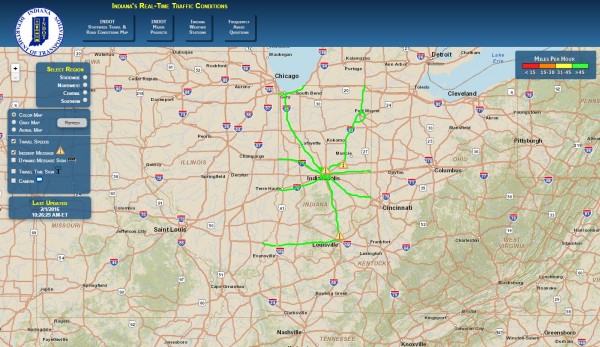
Indiana Department of Transportation Traffic-Wise Real-Time Weather Conditions — If you love looking at maps, this map shows Indiana weather conditions–and plenty of options to go with it. Choose among the state, Northwest Indiana, Central Indiana, or Southern Indiana. Use a gray map, one in color, or pick the aerial view. Finally, determine what it is you want to see. Choose among Indiana travel speeds, an “incident” message (represented by a yield sign with an exclamation point in the center of it), a travel time sign (to let you see the estimated travel times between different points), or (my favorite) the camera that lets you actually SEE what the road looks like at that point in time. Isn’t that neat? Talk about helpful and simple to use.

Indiana Department of Transportation Road Weather Information System
Indiana Department of Transportation Road Weather Information System — Road sensors display a range of information, indeed, it may be more than what is needed for the average tourist! You may browse atmospherics, like wind speed, if there is precipitation, and the current temperature at particular cities or towns in the state. View the pavement conditions. Is it dry? Icy? The date is included so you can get a better idea about how up-to-date the page really is.

TRIMARC Southern Indiana Road Advisory
TRIMARC — For southern Indiana (the Louisville area anyway), this is another clear and concise map that displays information travelers need to know. At the time of this writing, the right-hand side of the screen displays a fantastic summary of road conditions. If there is a disabled vehicle or road construction, this tool answers “when” and “where.” It provides the mile market, the estimated time, if there are any lanes blocked, and relevant notes. It’s a “must reference” page for Louisville and Southern Indiana travelers!
Indiana County Travel Advisories
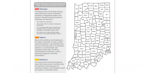
Indiana Department of Homeland Security — This website provides a handy way to view the status of every Indiana county. The travel status info is sent over by each County’s Emergency Management Agency, you know, the people that are actually in the area. Colors are used to denote how big of a problem the road conditions have become. The following facts have been taken from the Indiana Department of Home Security:
If you continue scrolling down the page, past the large map of Indiana county conditions, you will see an easy-to-read chart that displays when the information was last updated.

Travel Midwest-Northwest Indiana Road Conditions
Travel Midwest — The name might seem misleading, as this map appears to first deal with a particular area, however, the top left-hand drop-down tab displays its areas of coverage (mostly in Illinois). If you are traveling in the northwestern part of Indiana, you will find it particularly helpful. Sort through a series of overlays. Do you want to know if there is congestion? This map will show you where it is and its length. Accidents, and the lane or road closings associated with them are also available. Travel times, weather, construction, and events are a few of the other options.

ReBuild Indy Map
Rebuild Indy — Indianapolis area road conditions are available for those places that needed a little extra TLC. Drainage issues, falling apart roads and bridges, or flooding issues, whatever it is, projects are conveniently mapped. You can view what’s happening, where. Hover over an icon on the map to view more information, like the estimated beginning and ending date. My favorite feature is definitely the “oblique photography!” You can actually see what it looks like.
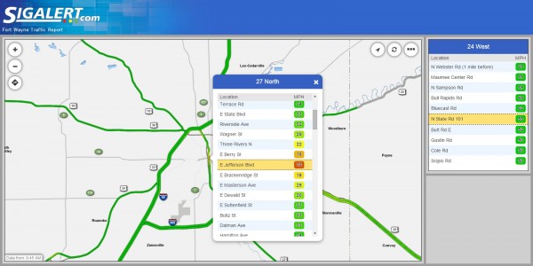
SigAlert Fort Wayne Traffic Report
SigAlert — This Fort Wayne area traffic report gives at-a-glance travel information. Flowing roadways are highlighted in green, along with the approximate miles per hour currently being traveled. Yellow areas are moving at a reduced speed and, as you may have guessed, red highlights are places where traffic has severely slowed to a crawl (or stopped entirely). SigAlert displays the speed traveled so you know where you stand.
For Indiana Weather Conditions on a Computer
Planning an Indiana trip often starts with a computer or laptop, at least, until (affiliate link) Little Indiana: Small Town Destinations comes out, right? Meanwhile, I’m sure you are taking advantage of the mapping function and search bar on Little Indiana.com to help plot your trip. For weather, browse the sites I’ve listed below.
National Weather Service — There’s nothing pretty about this black and white list of Indiana towns and cities but it does get the job done. It’s a trusted, reliable source for a reason!
The Weather Network — With options for each of the fifty states (plus Canada), there’s a lot of weather-related to be had! Unlike some weather sites, this one has weather-related videos and articles that aren’t spammy. It has all the essentials and will get the job done.
Weather Underground — Look for the city you are most closely located to and you can view the typical weather info. If there is any special weather activity, icons will draw your attention to the issue, so you can make the best decision.
Android Apps for Indiana Weather Conditions
1Weather Forecast Radar Ap
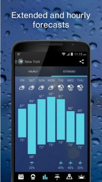
1Weather: Widget Forecast Radar With not quite a 4 1/2 star rating on Google Play, this app has a gorgeous interface, excellent weather tips, and a unique twelve-week forecast, it is creating rabid fans one download at a time.
WeatherBug Storm track map layer, current weather forecasts, and Nest or Honeywell compatibility make it more than a simple weather app. You’ll reach for this app “just because.” Nice and convenient.
Broken down by the hour, this app provides an “intensity” level as well as the time of rainfall. That way, I know whether or not I should grab the emergency umbrella out of the back of my car.
FREE Apple Apps for Indiana Weather Conditions
AccuWeather Weather for Life
AccuWeather – Weather for Life
Traveling somewhere in Indiana? Add your destinations to your favorites. It will list the current weather conditions. Handy and indispensable.
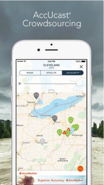
MyRadar NOAA Weather Radar – Forecasts, Storms, and Earthquakes
More than seventeen million people have downloaded this app for a reason! When my husband was in the wind industry, this was one app he turned to often.
Weather Underground: Forecasts, Interactive Radar, and Weather Alerts
Lots of weather-related data, excellent radar mapping and the updates are humorous. What more could you want?
Android Apps for Indiana Traffic Conditions
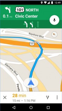
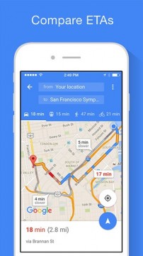
Google Maps
Live traffic conditions and rerouting makes it one convenient app. Without it, I’d never make it to my destinations! You think I am kidding? This is a “can’t live without” app in my book.
Have address, will travel! Get there easily. Oh, and if you travel in Indiana where the signal is frequently dropped (like I do), look for the in-app option to download offline navigation.
We’ve avoided more than one super lengthy interstate slow down thanks to this app. Users can update the current traffic conditions, like traffic jams and accidents, easily.
Apple Apps for Indiana Traffic Conditions and Navigation
Google Maps App
It’s a classic for a reason. Some things just don’t go out of style. Use it on your phone or iPad and make getting there simple. I love that it still runs while I am listening to Spotify through BlueTooth on my iPad.
Scout GPS Navigation, ETA, Maps & Traffic
Chat in-app, avoid freeways, and easily access “favorites” or recent locations. There are many options with this app. Only drawback? There’s a small fee for offline navigation access.
Waze – GPS, Maps & Social Traffic
My husband’s favorite whenever we travel together. Use this app when you have traveling company, so you can safely add updates, and be on top of slowed traffic or quick stops without becoming a hazard.
Watch for Warnings
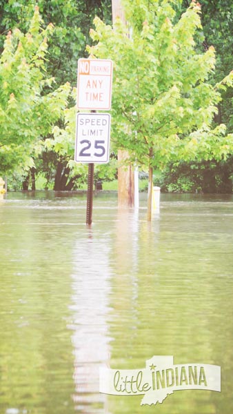
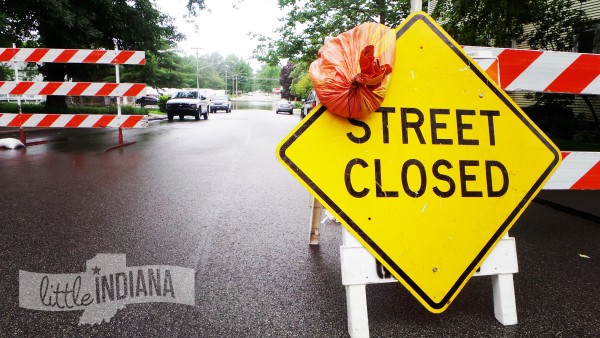
A Street Sign is Surrounded by Water
Always pay attention to the signs of an area. I know, it’s common sense…but then again, even I made a mistake. When I was traveling through a hillier part of the state, I saw a sign that read “High Water.”
There was no high water to be seen. I crossed over a hill, then another, and then another–when suddenly I could see the road ahead of me was covered in water! I did not have much time to slow down before plowing through it.
While the location of the sign was a bit ridiculous given how far I traveled until I actually saw the water, maybe the water receded or maybe there wasn’t a better place to put it. I don’t know.
But I can tell you I will pay a lot more attention to a “High Water” sign after that!
Trouble on the Road
What do you do when the worst happens? You have a great option if you are located in the particular area mentioned below.
Hoosier Helpers — Did you misjudge how far you could go on that tank of gas? Did your tire get a flat? No matter what your minor vehicle emergency, the Hoosier Helpers are cruising the roads, just looking to help. Their goal? Keep traffic moving. In Indianapolis, Northwest Indiana, and Southern Indiana (near Louisville, Ky), you’ll see their van or truck.
Indiana Weather Warnings and Road Issues

How To Find Indiana Travel Warnings
How do you like this handy list? If you found it useful, say “thank you” by sharing it with your friends or pinning it on your social networks.
With so many apps out there, and new apps making an appearance all the time, I’m sure there’s more great apps that could be featured. Do you have a new fave? I’d love to hear it!
Please feel free to share your favorite Indiana weather advisory and road condition apps in the comments section below.

Indiana Travel Tips
App images belong to owners of the apps listed above. They are not my own.
Small Towns: Destinations, not Drive-Thrus. I’m Jessica Nunemaker and THIS is Little Indiana.
Just don’t forget to tell them that Little Indiana sent you.
Targeted. Relevant. Affordable! Little Indiana advertising.